Blaeu atlases often served as official gifts from the Dutch Republic to foreign dignitaries.
Official cartographers to the VOC, the Dutch East India Company, the Blaeus had unrestricted access to the company’s unpublished manuscript maps and charts, together with the reports and journals of the VOC’s ships.
A series of large-scale wall maps formed a hugely important part of the Blaeus’ output, but by their very nature such maps were susceptible to damage. Linen-backed and attached to wooden rods for display, they could suffer from careless handling, the detrimental effects of sunlight, heat, damp, even soot.
Once damaged, or indeed geographically superseded, they were likely to be discarded and are today great rarities.
The British Library boasts the ‘Klencke Atlas’, a remarkable assemblage of 42 such wall maps (mostly by the Blaeus) that in 1660 was gifted to Charles II by Dutch merchants to mark his restoration to the English throne, but the appearance in the salerooms of Blaeu wall maps of that period is something cartographically special.
Southeast Asia and Australia
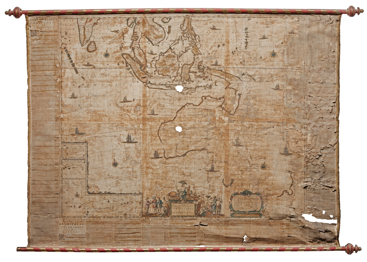
A Sotheby’s sale of May 9 will include two maps issued by Joan Blaeu in 1659. Both are in unrestored, original condition but the most significant of them is ‘Archipelagus Orientalis Asiaticus’.
A map of Southeast Asia and Australia, it is one that in Gunter Schilder’s cartographic reference work of 1976, ‘Australia Unveiled...’, is described as “possibly the best general map of Dutch sea power executed in the 17th century...” and one which contains “...all Dutch discoveries in Australia and those in Tasmania and New Zealand of Tasman’s first voyage”.
As the illustration above shows, it is discoloured, holed and subject to other damage that has resulted in losses to both the map itself and the side and lower text panels. For all that, it is possibly one of only two surviving copies of the map in this state – the other being that in the Berlin Deutsche Staatsbibliothek.
The copy in the aforementioned Klencke atlas, another in the Rostock University Library and a copy acquired by The National Library of Australia in a Swedish auction all appear to be slightly later printings.
This rare survivor, measuring 3ft 10in x 5ft 2in x (1.17m x 1.59m), is valued at £200,000-250,000.
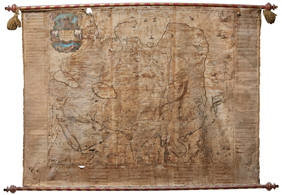
The Asia map by Joan Blaeu valued by Sotheby’s at £60,000-80,000.
The second map, which would again seem to have made no previous appearance in auction or dealers’ catalogues, is a copy of Blaeu’s ‘Asiae descriptio novissima’.
Similar in format and size, and slightly better preserved, it carries an estimate of £60,000-80,000.
A third cartographic highlight of the Sotheby’s sale is a complete and fully coloured copy in near contemporary calf of the 1676 edition of John Speed’s ‘Theatre of the Empire of Great Britain... [and] Prospect of the Most Famous Parts of the World’ – containing 68 and 28 maps respectively.
The current auction record stands at £92,000, set by Dominic Winter in 2011, but this copy is valued at £100,000-150,000.
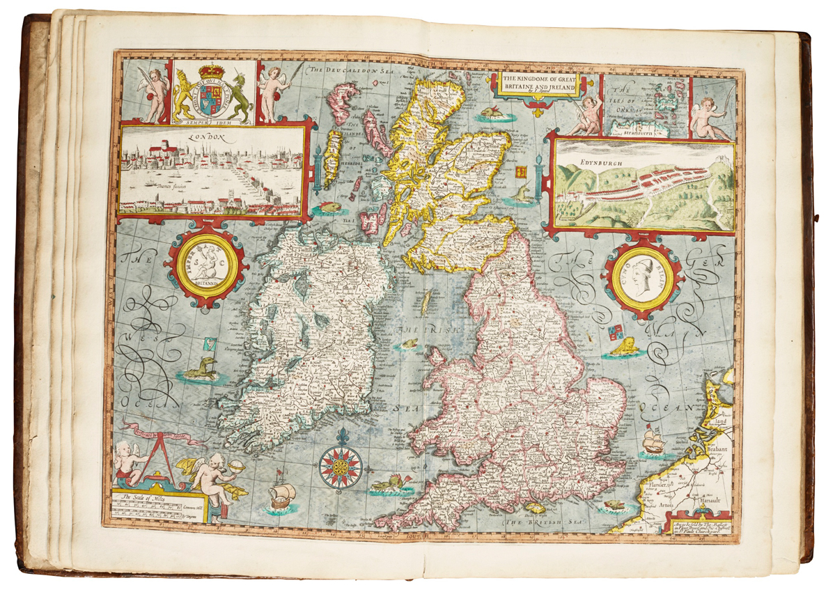
The ‘Britaine and Ireland’ map from a 1676 edition of Speed’s ‘Theatre of the Empire of Great Britain... [and] Prospect of the Most Famous Parts of the World’ that is valued by Sotheby’s at £100,000-150,000 in their May 9 sale.