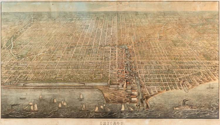
The other three copies of JT Palmatary’s 1857 bird’s-eye view of Chicago are held in libraries around the US. The copy now offered at Leslie Hindman Auctioneers is the only copy to come on the market for at least 100 years and offers a snapshot of the city.
It was completed before the Great Chicago Fire of 1871. It includes a view of the Illinois Central Railroad, which at the time was the longest railroad in the world completed a year before the map. It also shows ‘The Sands’ in the lower right-hand corner, which was known for having a high concentration of brothels and gambling dens. The area became a point of refuge for displaced citizens following the fire.
Palmatary is known for his aerial views. This one was published by Brauhold & Sonne and is estimated at $20,000-30,000.
It is included at Leslie Hindman’s sale of fine books and manuscripts on September 13.


