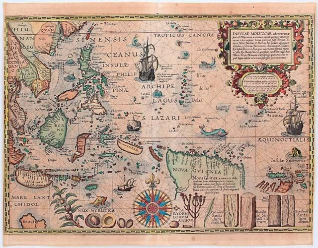
Issued by CJ Visscher in Amsterdam in 1617, but originally engraved by Johannes van Doetecum for Petrus Plancius and first published in 1592, this map has been described in David E Parry’s The Cartography of the East Indian Islands as “one of the most fabulous charts ever produced of the East Indies and one of the rarest… [showing] the Spice Islands at a level never previously seen.”
Depicting Sumatra, the Phillipines and adjoining coasts, along with New Guinea and the Solomon Islands, it also includes, in a bottom corner, a bit of Australia labelled ‘Beach’. Also depicted at the bottom of the map are the spices nutmeg and clove, along with red and yellow sandalwood.
The copy in the German sale was in the third and final state. It showed overall browning and spotting and, previously framed, had its outer margins reinforced.


