A few books and photographs were included, but it was the maps and atlases that brought the high bids. Several of them brought substantial five-figure bids, but two went higher still.
American maps landmark
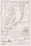
Sold for $100,000 (£72,465) was a framed example of the 1755, third edition of John Mitchell’s Map of the British and French Dominions in North America, first issued just two years earlier.
A folding wall-map of 32 sections on eight sheets, this was the primary political treaty map and, running to 21 editions and impressions over 26 years, is regarded by many as the most important map in the history of American cartography.
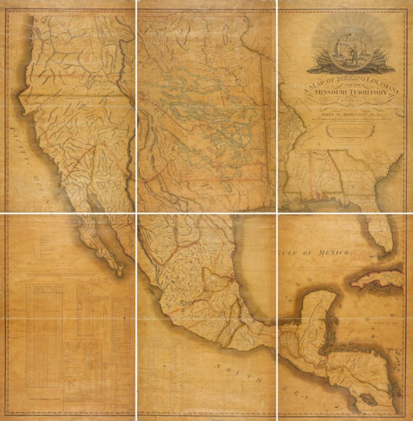
Sold at a record $280,000 (£202,900) was an 1819 first issue of a seminal map of the American south-west, John Hamilton Robinson’s Map of Mexico, Louisiana and the Missouri Territory…
The first map to delineate the borders of Texas and Louisiana as established by the Adams-Onís treaty of that year, this six-sheet map, measuring 5ft 10in x 5ft 8in (1.78 x 1.72m) and mounted on linen and framed, is known in only 10 or so copies.
This example was originally one of three deposited by Robinson with the Library of Congress in order to secure copyright, but was later acquired by Thomas Streeter and in the 1960s was sold as part of his vast Western Americana collections to Yale. It was later deaccessioned as a duplicate.
Revolution record
In the same New York sale, but from a different source, came a copy of William Faden’s North American Atlas of 1777, the contemporary and most famous cartographic record of the course of the American Revolution, which sold at $240,000 (£173,915).
Combining separately issued regional maps and battle plans, this was essentially a bespoke atlas and the small number of extant examples vary in the numbers of maps present and their content.
This one, like the largest of the two copies in the Library of Congress, offered 27 maps, charts and plans on 31 sheets, some of them hand-coloured.
However, in 2015 Swann sold for $280,000 (then £186,665) a copy containing no fewer than 42 maps and plans.
Among the more significant contents of this latest example was a copy of Braddock Mead’s 1774 …New England map, the most accurate and detailed map of the region produced during the American colonial era, and a very rare battle plan.
The latter was a previously unrecorded and possibly suppressed first issue of Faden’s 1776 Attack and Defeat of the the American Fleet under Benedict Arnold… upon Lake Champlain….
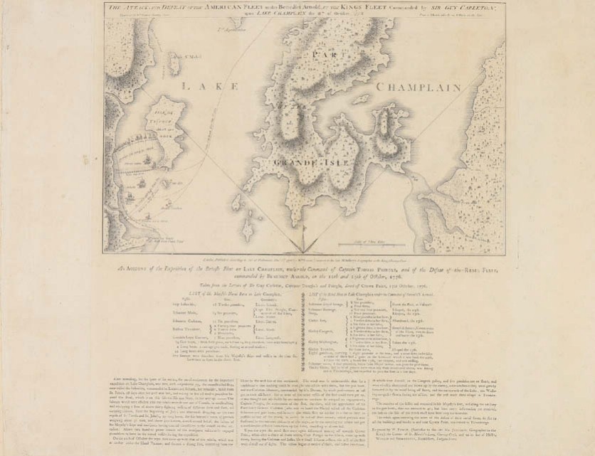
The rare first issue of Faden’s 1776 Attack and Defeat of the the American Fleet under Benedict Arnold… upon Lake Champlain…, sold at $240,000 (£173,915).
This is the first of two reports focusing on recent sales of maps and globes. The latter will be featured in the second selection.