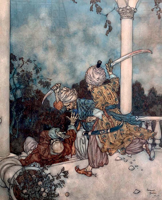

This ink and watercolour heightened with white shown above by Edmund Dulac (1882-1953) is titled The Two Brothers of Fatima Kill Bluebeard.
Signed and dated October 1910, it was among the works that featured in an exhibition of Dulac’s work held at the Leicester Galleries, London, at the end of 1910.
The estimate is £5000-7000 at David Lay in Penzance on January 30-31.
davidlay.co.uk or see this item on thesaleroom.com
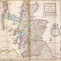
This fine example of early 18th century cartography, The World Described; or, a New and Correct Sett of Maps by Herman Moll, was given to the Dame Alice Harpur School in Bedford in memory of Norma Wilkinson, a geography teacher who died in 1968.
The school has been unable to display the atlas safely and instead hopes to sell it at W&H Peacock in Bedford on February 7 and invest the proceeds in a new weather station for the geography department. The estimate is £20,000-30,000.
The 31 folding maps and an astronomical chart were individually made by Moll between 1706-30, each with engraved vignettes of cities, landmarks, inhabitants, flora and fauna. Pictured above is The North Part of Great Britain called Scotland dated 1714.