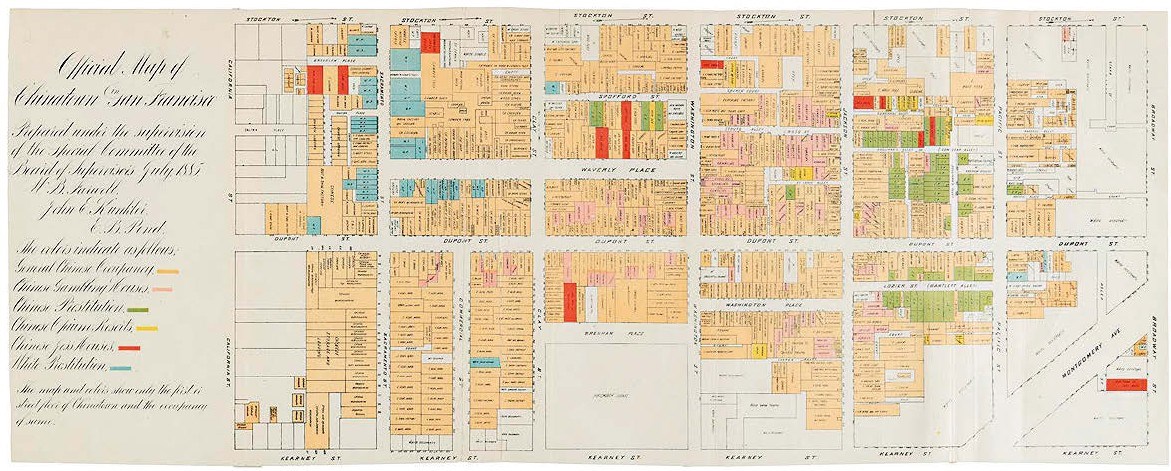
Highlights included a 21in (53cm) wide Official Map of Chinatown… of 1885 which employs different colours to highlight such residential and business categories as ‘General Occupancy’, ‘Gambling Houses’, ‘Opium Resorts’, ‘Joss Houses’ and ‘Prostitution’. It was sold at $12,000 (£9230).
However, as the cataloguer pointed out, “the map and colours show only the first or street level of Chinatown and occupancy of same”, leaving out the notorious underground.
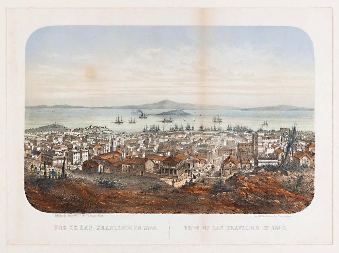
A now rarely encountered 1860 view of San Francisco, sold at $8500 (£6540) by PBA Galleries.
Tears along the folds to verso have been repaired with archival tape, but bid to $8500 (£6540) was a tinted litho view of San Francisco. Looking toward Yerba Buena Island, it dates from 1860, the tail end of the gold rush years.
Though printed in Paris with French and English titles, it was published in California by Henry Payot, who was born in South Carolina of French parents and was just 13 when he arrived in San Francisco during those golden years. He worked initially for lithography firm Quirot & Co but later founded his own business.