About 400 copies of his map were produced and it was reduced in scale in 1820, with copies of this map known to have been re-issued in 1824, 1827 and 1828, although it is unclear how many editions with these dates were produced.
It was an 1824 edition that came up for sale on May 18 at Devon auction house Chilcotts (21% buyer’s premium), estimated at £600-800 but sold at £7200.
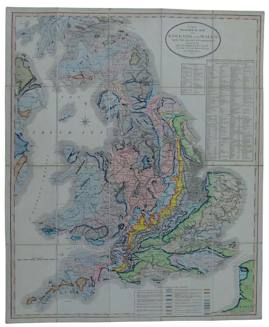
A New Geological Map of England and Wales with the Inland Navigations exhibiting the Districts of Coal and other sites of Mineral Tonnage by William Smith, Engineer, 1824 was published by J Cary, 86 St James’s Street, on March 18, 1824.
The engraved map featured contemporary hand colouring, and was laid on linen, 2ft 1in x 2ft 6in (64.5 x 77cm). It came in a retailer’s slip case for C Smith, no 172 Strand.
At a time when the Industrial Revolution meant the nation was hungry for raw materials, The Society of Arts offered a reward of 50 guineas in 1802 for anyone who could produce a geological map of Britain. Smith was awarded the prize for this production.